In a unique association, the Municipal Corporation of Greater Mumbai (MCGM) and Google have collaborated to mark Containment Zones in the city on the Google Maps.
Looking at the size of the metropolis and volume of population, the information about the various Containment Zones marked on the maps was already being provided on the civic body’s website.
But, the availability of this information on Google Maps will further make it easy to access for the Mumbaikars while on the move with just one click.
AIR correspondent reports, making optimum use of technology, the BMC has now provided on Google Maps, information about civic-run hospitals and COVID Care Centres besides marking Containment Zones.
This will help Mumbaikars to know the COVID infection situation in the city.
To view this info, click on “COVID-19 info” on the Google Maps, zoom in the Mumbai Metropolitan Map, the Containment Zones are seen marked in grey colour with labelled COVID-19 containment zones.
The civic body has said since the service has been started recently and necessary changes will be made as and when required.
Also after clicking on “COVID-19 info” on Google Maps, if one goes to BMC option, the user is directed to the BMC website www.stopcoronavirus.mcgm.gov.in, which too provides similar information.
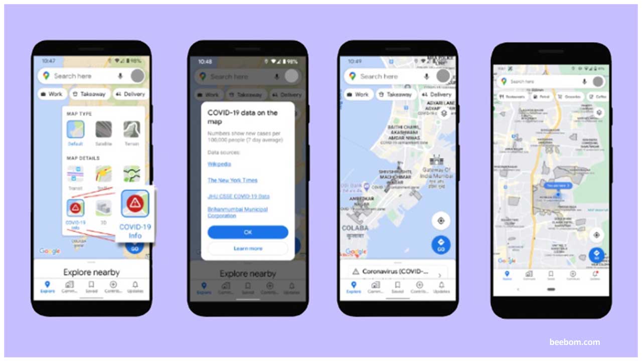
 In a unique association, the Municipal Corporation of Greater Mumbai (MCGM) and Google have collaborated to mark Containment Zones in the city on the Google Maps.









.jpeg)

.jpeg)







.jpg)




.jpg)

